top of page

Search


Revolutionising internal inspections with drones
When it comes to internal inspections of difficult-to-reach or hazardous areas, drones are an increasingly valuable tool that offers safety,
Rennie Campbell
Nov 20, 20242 min read


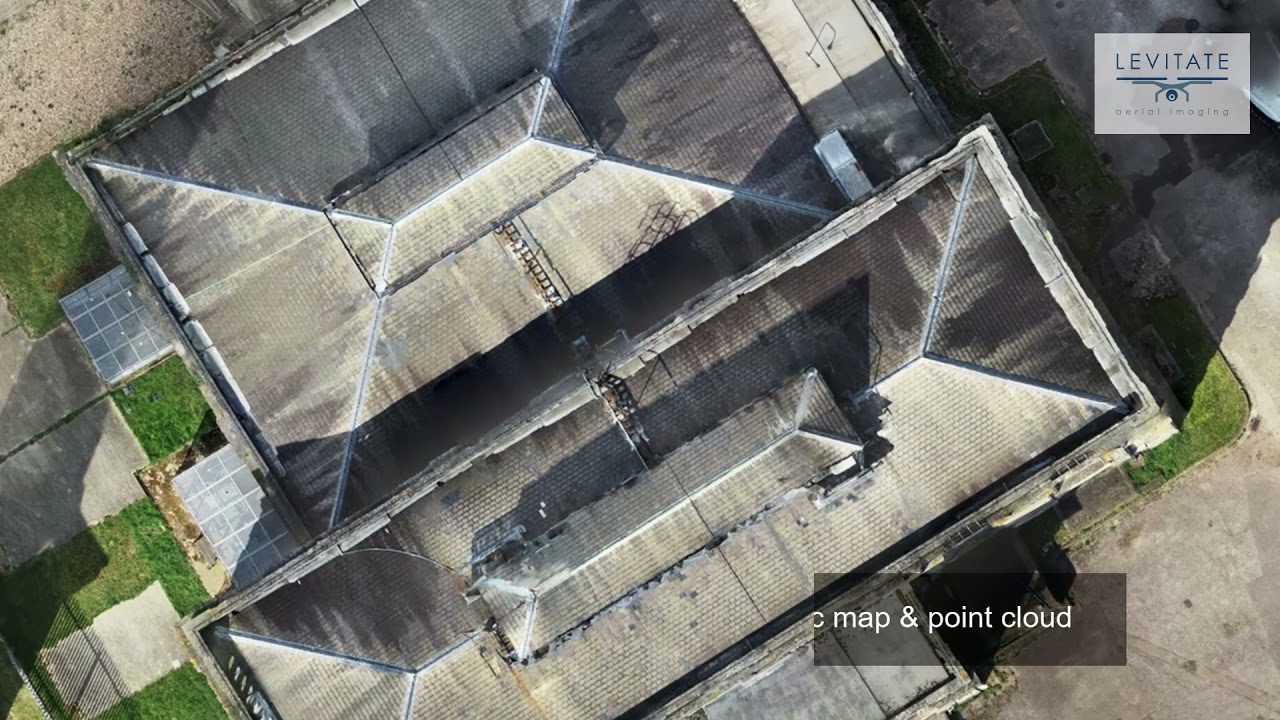
Demolition planning using 3D models generated from drone imagery
Levitate was recently tasked to create a 3D model and point cloud of an old pipe bridge over a canal to help the civil engineering and const
Rennie Campbell
Nov 11, 20241 min read


Enhancing drone building inspections with Hammer Missions
In the fast-evolving world of drone technology, Levitate is continuously seeking ways to streamline operations, improve accuracy and enhance
Rennie Campbell
Nov 4, 20242 min read


Revolutionising roof inspections
When it comes to roof inspections, drones offer a myriad of advantages that traditional methods simply cannot match
Rennie Campbell
Nov 1, 20242 min read


36 buildings, two days, +1,000 images...
Levitate completed one of our larger projects recently, inspecting 36 buildings at Roedean School on the south coast near Brighton as...
Rennie Campbell
Jul 5, 20221 min read


Beside the seaside: Church roof inspection in Margate
Levitate was commissioned to conduct an inspection of a storm-damaged church roof in Margate. The listed building suffered badly during...
Rennie Campbell
Jun 30, 20221 min read


Pre-works contaminated land condition assessment
One of Levitate's regular clients was commissioned to clear contaminated land on the edge of Romney Marsh on the stunning Kent coast. As...
Rennie Campbell
Feb 21, 20221 min read


Drone inspections - not just roofs
Drones are great tools for external inspections of hard to reach places, but they can do far more as a recent project illustrated....
Rennie Campbell
Feb 8, 20221 min read


Historic property aerial inspection
This stunning historic Devon country home was undergoing a comprehensive condition survey last year, including a roof inspection....
Rennie Campbell
Jan 31, 20221 min read


6 checks to make when hiring a drone operator
Drones are fantastic tools to map large areas, conduct inspections and surveys, generate 3D models and impressive images and film, but...
Rennie Campbell
Jul 19, 20211 min read


3D models and points clouds from drone imagery
Drones can do far more than capture great and unusual imagery: they're a fast, safe and efficient means of gathering high quality data to...
Rennie Campbell
Jun 24, 20211 min read
Aerial asset inspections
Our new video highlights the many benefits of aerial asset and building inspections, from saving time and money to creating a digital record
Rennie Campbell
May 6, 20211 min read
"That is spot on, it really paid off taking the risk!"
Our recent culvert inspection quickly and safely generated the detailed information required to help Land & Water assess the work...
Rennie Campbell
Apr 20, 20211 min read


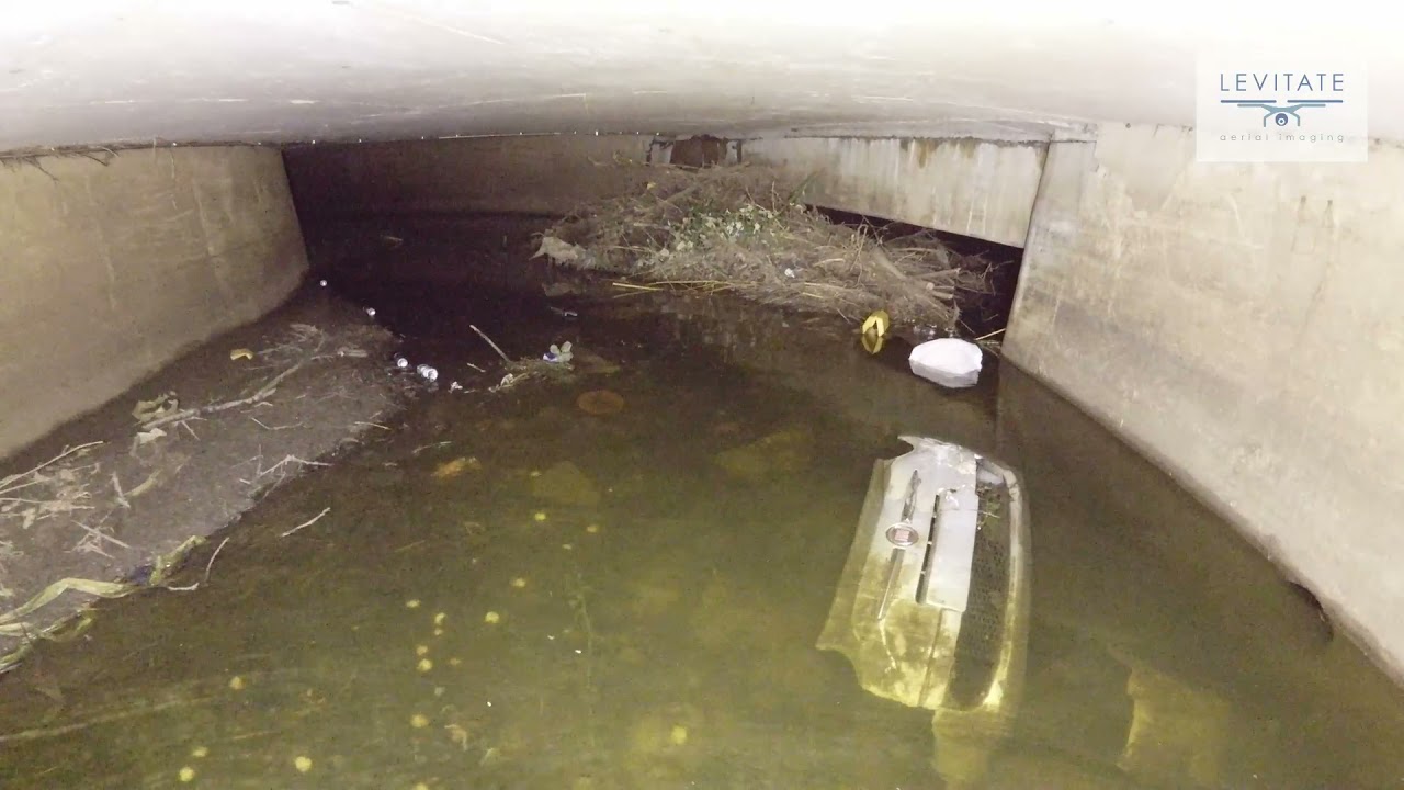
Culvert inspection by drone
One of Levitate's clients, working on behalf of the Environment Agency, was tasked to assess a partially blocked culvert in north London...
Rennie Campbell
Mar 31, 20211 min read
bottom of page